


With the Noel Kempff borochi project pushed to October, I found myself with ten days and nothing pressing to fill them.
So I bought a ticket to La Paz. (You didn’t see that one coming, now did you?!) There were friends to see, an obligation of the sad kind to fulfill, and a promise I had been carrying for a while — a long-deferred visit to my friend Jaime's property at Pongo Bella Vista, in the Yungas.
The promise had been outstanding long enough that it had started to feel like something I talked about rather than something I did.
That is usually the point at which I buy a ticket.
Runway 28
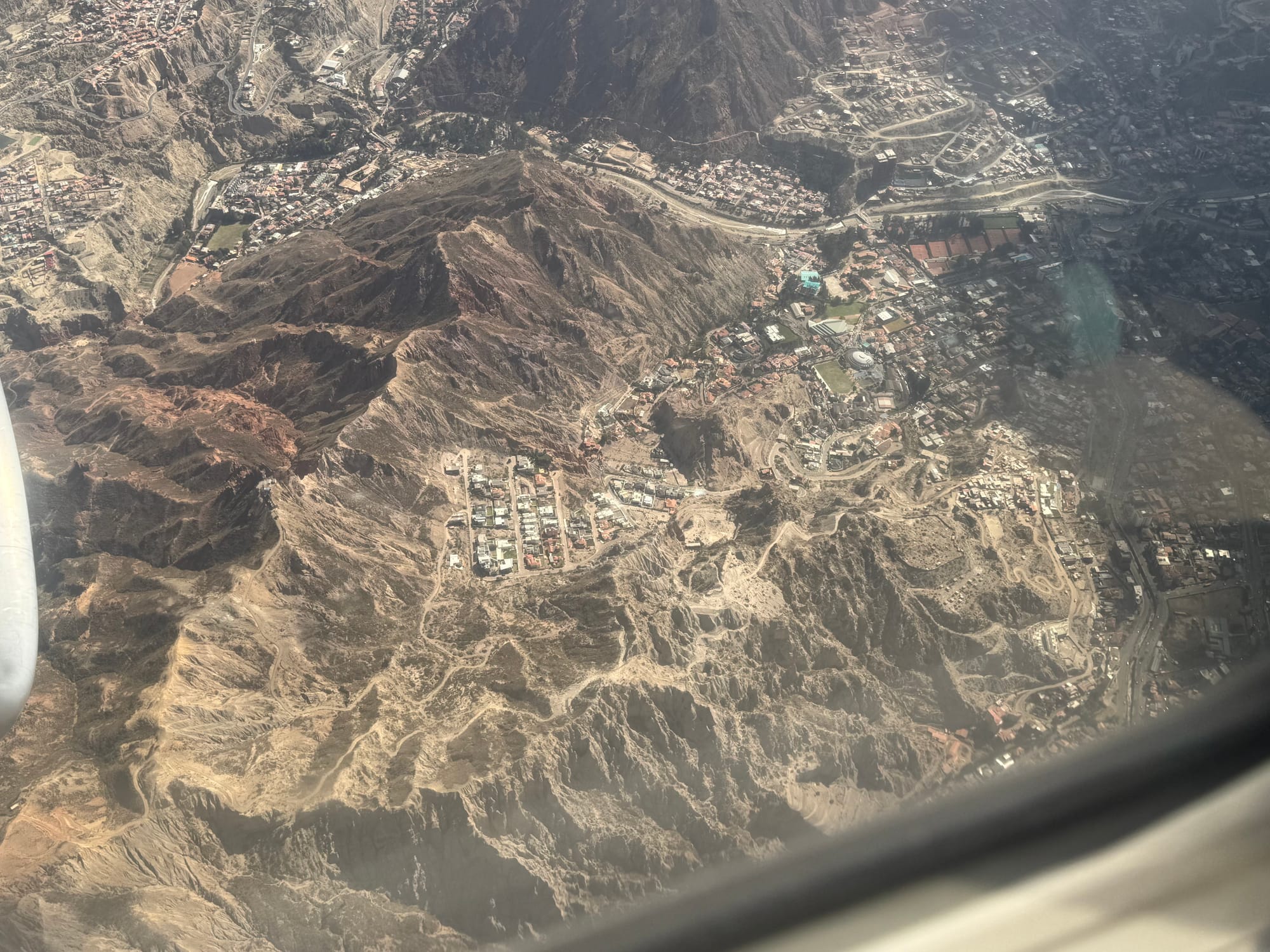
The approach into El Alto was unusual for me. Nearly every flight I‘ve taken into La Paz, domestic or international, has come in from the west onto runway 10. This one came from the east, onto 28.
The skies were clear. As we crossed the city I could make out the neighborhood in La Florida where I lived as a boy, passing almost directly beneath us.
That gift was offset, shall we say, by the instinctive urge to lift myself slightly off the seat as we neared the edge of the Altiplano — where the city's inhabitants have built neighborhoods that seem to spill over the precipice like a cascade of red brick — and then, crossing the plateau itself at what felt like a few meters of clearance, in the quiet hope that we won’t need a go-around.
We did not.
Down To Coroico
The taxi dropped me at Jaime's house on Calle Venezuela. It took several turns to find, even though the driver knew the area well.
Jaime Chambi Aguirre is an Aymara anthropologist and attorney from Achiri, on the Altiplano near the Chilean border. He is careful in the way he explains things, which I have come to understand is a habit of both his professions. We talked at the house while we waited for Oscar, our driver, who had taken Jaime up to the property before.
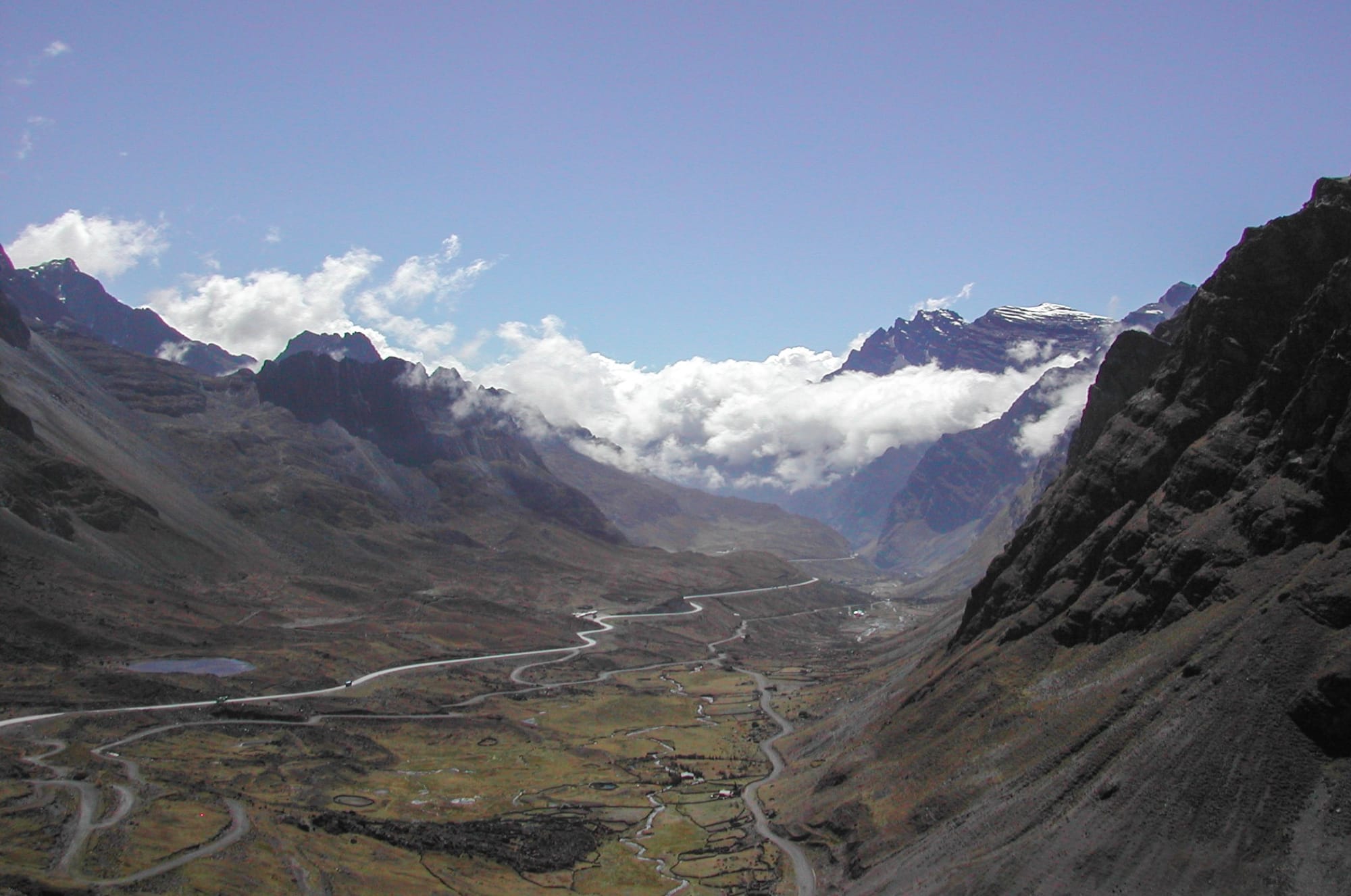
Shortly before reaching La Cumbre, at about 4670m — the highest elevation we’d reach before dropping into the Yungas — we stopped for gasoline. The station wasn't crowded — we were simply lucky with the timing. There were shortages at the time, and over the following days we would pass more than one station with nothing to sell.
By the time we reached La Cumbre, the sky had gone foggy and overcast. The farther we descended, the darker and thicker it became.
Traffic was lighter than I expected, probably for the same reason the station was empty.
We made our way down the winding Yungas highway, which years ago replaced the old road as the principal route from La Paz.
We reached the Hotel Gloria in Coroico around 8:30 p.m. I settled in and went straight to bed.
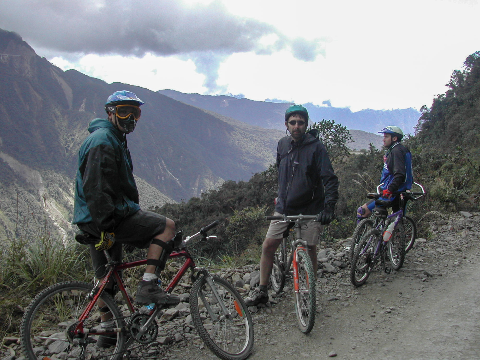
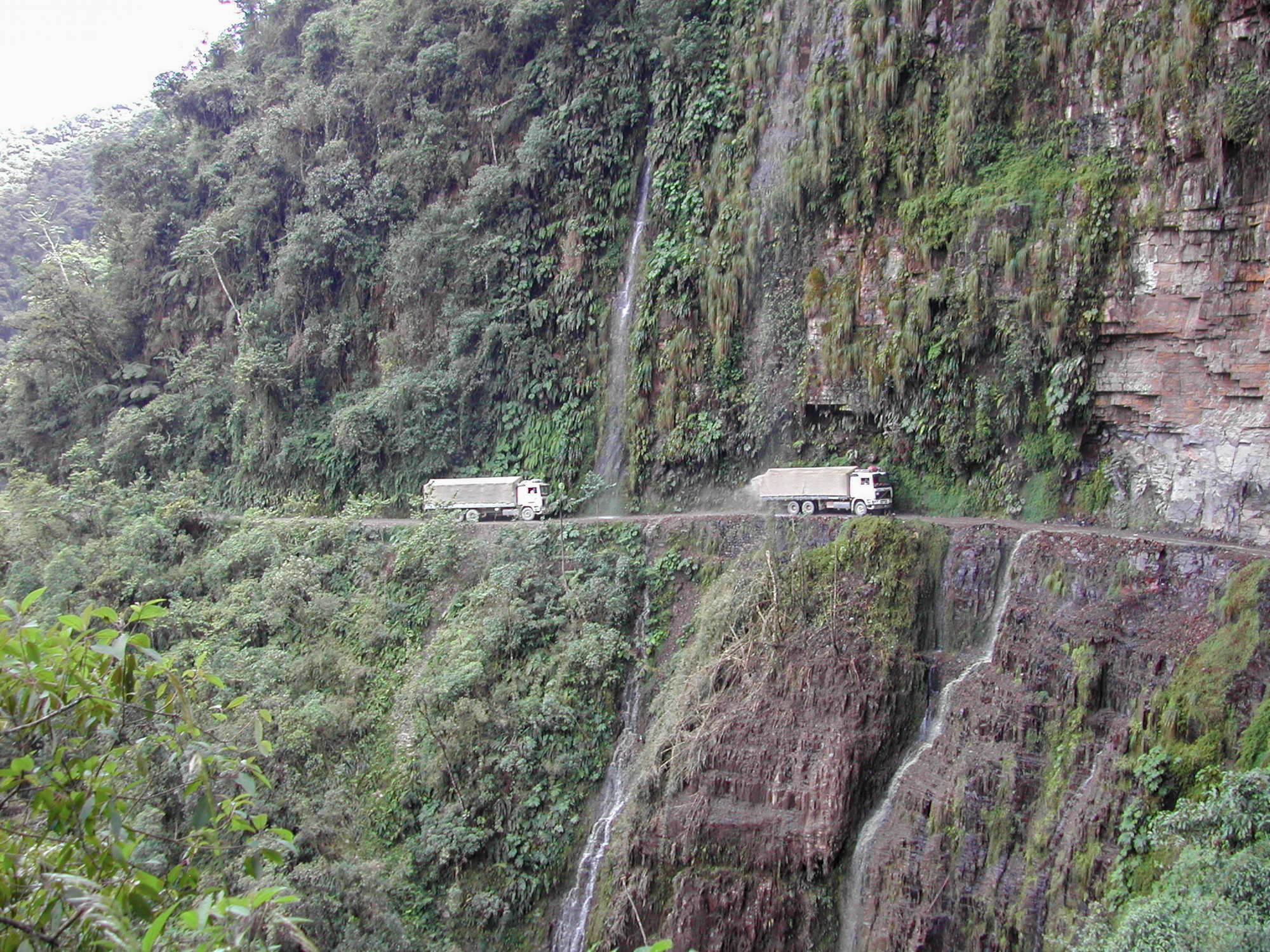
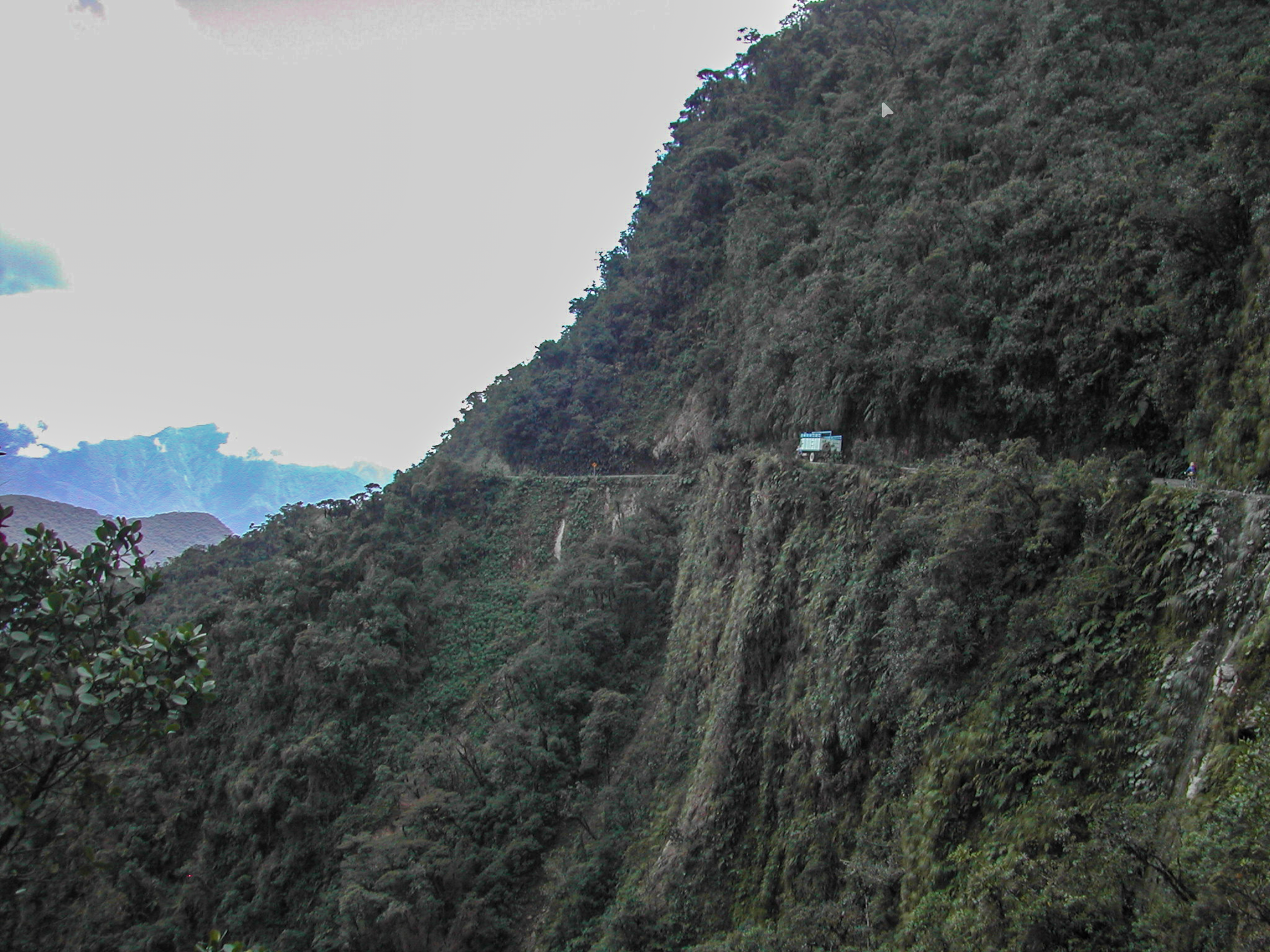
Until 2001, I hadn’t been down the Camino de la Muerte in over thirty years… over the next several years, by various modes.
The Road, Then
The old road is a tourist destination now. People ride bicycles down it.
In the late 1960s it was about as much adventure as a ten-year-old — or, for that matter, an adult — could find just about anywhere on the planet.
I remember waking early and loading the last of our gear into the yellow carry-all, a Chevrolet I think, and heading up toward La Cumbre. Then the drop into an enormous valley, barely discernible in the morning twilight.
What also became discernible, as the light came up, were the precipices along one side of the roadway. And the crosses. Sometimes a single one, sometimes a collection of them. It would be some years before I understood what they were, though I suspect it was immediately obvious to everyone else in the vehicle.
Descending traffic did not have the right of way. When we met the trucks climbing up from the agricultural lands below — still two thousand meters up — we reversed to the last widening in the road and let them pass on the mountain side.
I remember looking almost straight down into it.
I remember my sister crying quietly in the back.
We made that trip twice, I believe, in our two years in Bolivia, and the memory of it holds a particular place for me. I will admit to having contaminated it somewhat in 2001, on my first return to the country, when I rode a mountain bike down the same road with friends.
I don't entirely regret that ride. But I wouldn't do it again. Or so I believed until my friend Scott came to visit five years later…
Six In The Morning
I woke early to the full-throated cries of Speckled Chachalacas, joined shortly by the raucous chorus of Mitred Parakeets swarming over the treetops, seemingly uncertain of their destination.
Maybe that was the point.
The night guard kindly tracked down some hot water and a cup, and I made coffee with the Starbucks instant and lactose-free creamer I travel with — a small indignity I‘ve already made my peace with.
On the veranda outside our rooms, Jaime and I talked at length about the property, and about the area and its history more broadly. It became apparent fairly quickly that we would need to come back and do this properly, with a recorder running.
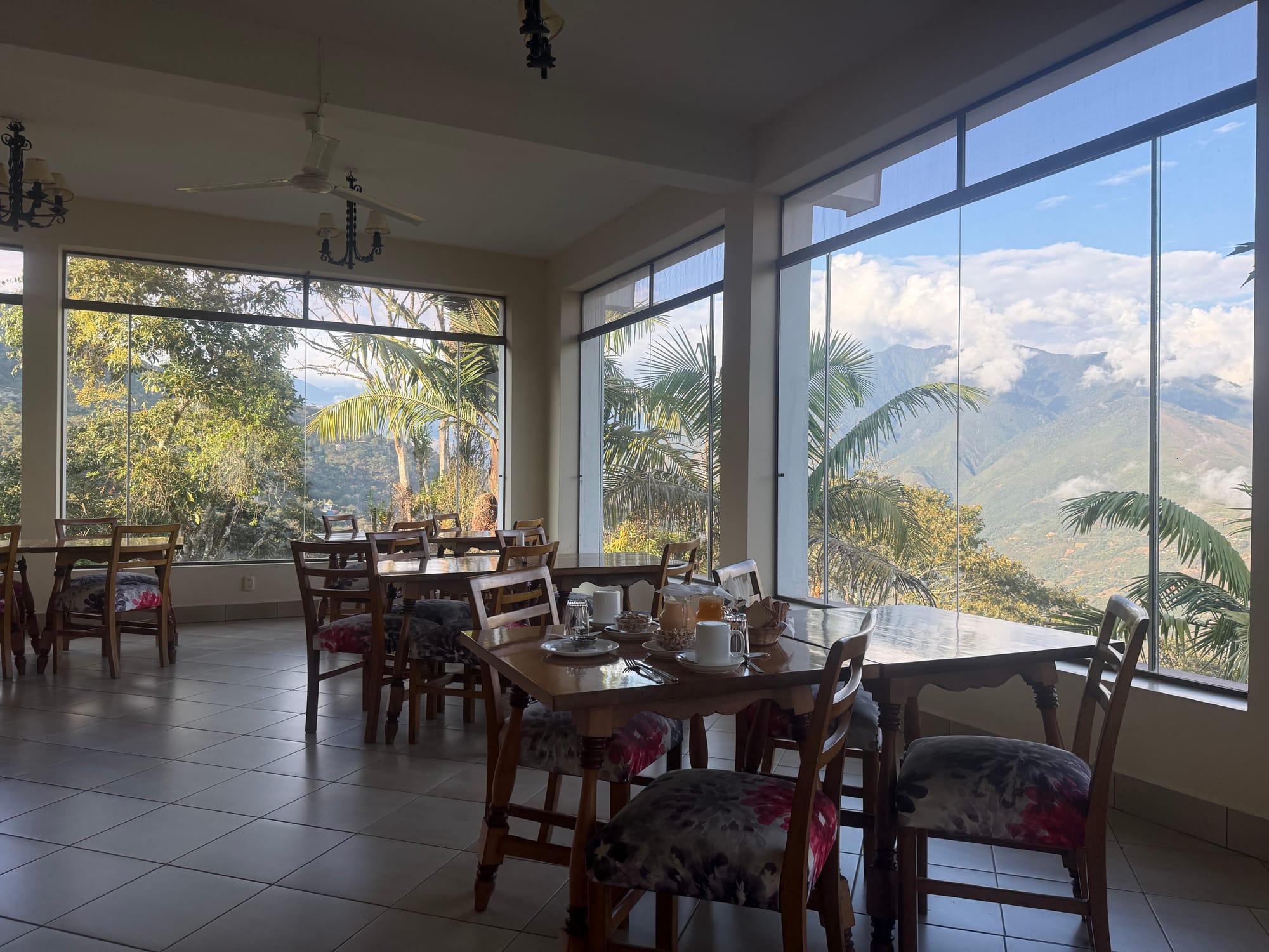
Breakfast came with a view over the valley.
Lidio
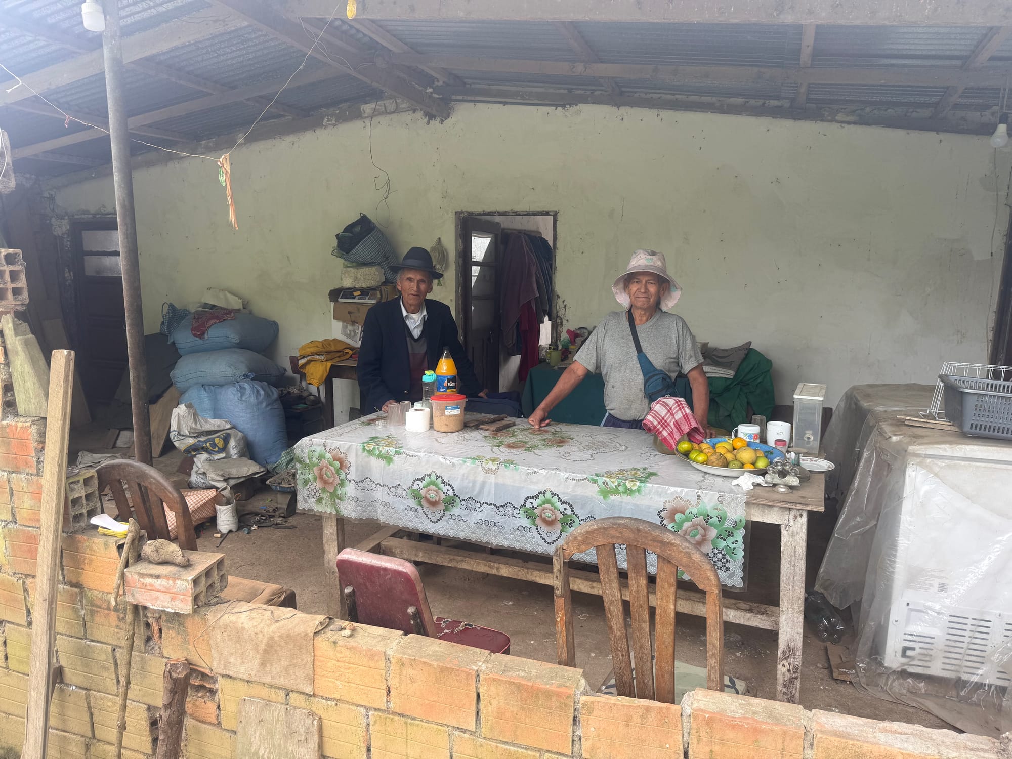
About two hours up the road, we stopped for lunch with Lidio Ibarra — homemade soup — at his property, about two thousand meters up and just off the highway. Lidio was standing outside his gate along the road, waiting patiently for our arrival.
Lidio is from Potosí, studied in Camargo, and arrived in the Yungas in 1997, around the time the new highway was beginning to take shape. He married a local woman and stayed. At some point the community made him its legal representative in a land dispute, which he pursued and, eventually, won. It cost him a great deal. He has his property still.
He also happens to be a retired professor of language, and he moved up here permanently around 2019, just ahead of the pandemic.
He grows yuca, tomatoes, choclo, locoto, potatoes, rosemary. He keeps stingless bees, and he walked us through the roles — la reina, las obreras, the outsized zánganos — and pointed out one of their preferred shrubs, a Baccharis with small aster-like blossoms, out of season now but common throughout the region. Jaime showed pointed out matico, Piper aduncum, which the regional health service recognizes as one of the more culturally important remedies in popular medicine here. It came into its own during the pandemic, with its respiratory relief properties.
Then there were the chickens. One room held roughly two hundred and fifty broilers, four or five weeks old, around two kilos each with another couple of weeks to go before sale. Another room held about the same number of chicks only a few days old, bought at eight to ten bolivianos apiece.
I later realized I had forgotten to take one with me. Forgive me, sister — it would not have been a rescue mission.
The strangest thing on the property hangs from the trees. Enormous fruits, virtually indistinguishable from watermelons, growing on vines so vigorous that when they tangle into a shrub or a tree they appear to be growing out of it, dangling from the branches in a way that doesn't quite make sense. Citron melons, as it turns out, usually put up as preserves or candied.
Lidio found one within reach and cut it loose with a machete. It was heavy enough that the four of us had to pass it up the slope hand to hand to get it to level ground. Jaime took it home.
Lidio describes Coroico as the historical capital of the Yungas, with Caranavi later assuming much of that role as it grew.
He and Jaime have known each other since colegio. Almost forty years.
We said our goodbyes with a loose plan to return for a picnic.
The Bridge
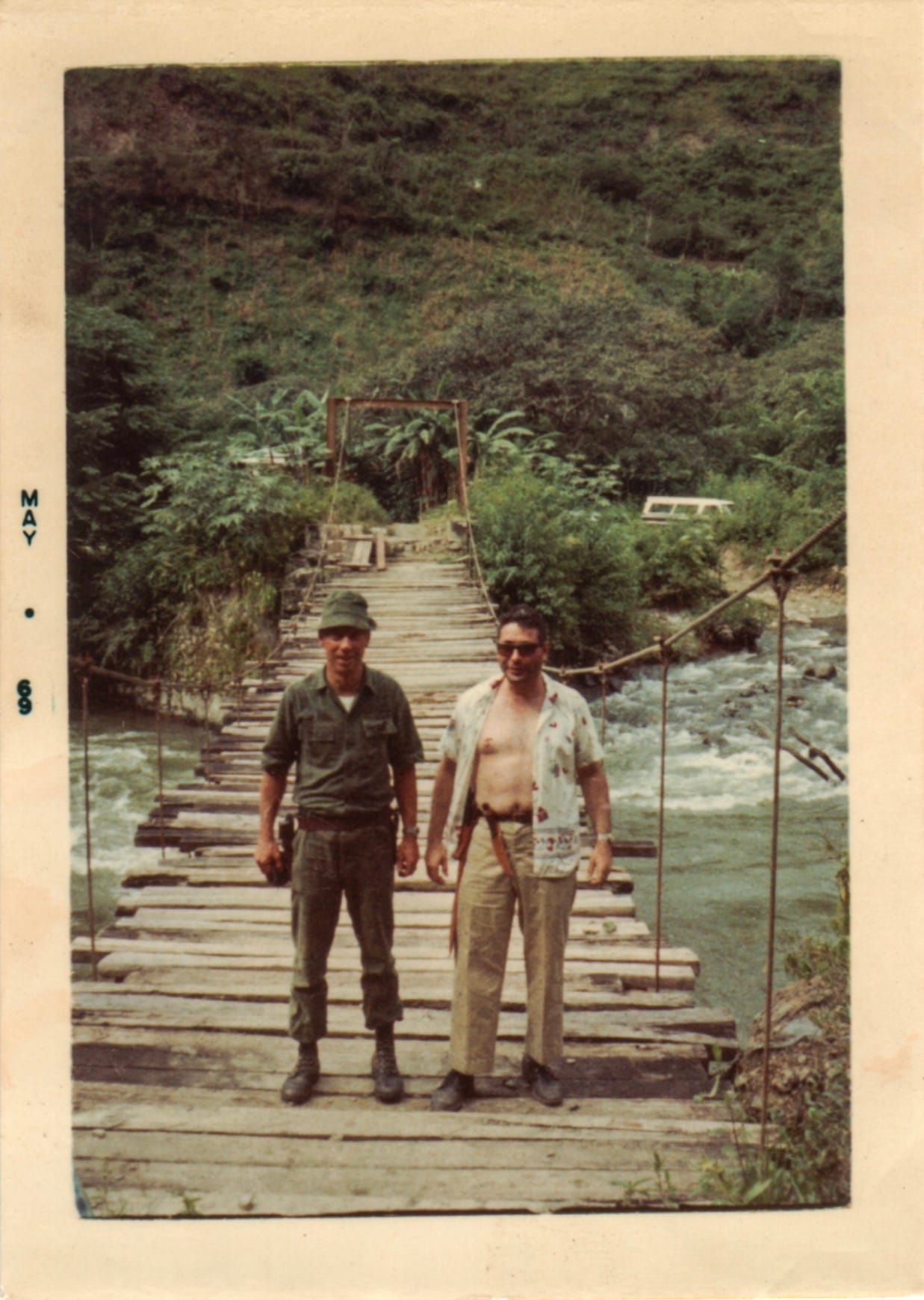
I had brought a photograph with me.
It was taken around May of 1969 — the processing date is stamped in the border — on my mom’s Kodak Duaflex III on 620 film, and shows two men standing on a single-lane suspension bridge with a plank deck. My father on the right. On the left, Maj. O. K. Hill. Behind them the bridge runs off toward the far bank and the hillside rises steeply. Below and to the right, the river is moving fast over rock.
I have a second photograph from the same trip. A boy, barefoot on a cobble bar, fishing that river. Yours truly.
I showed the bridge photograph to Lidio.
He looked at it for a moment and said it was the old bridge at Yolosa. He said it isn't there anymore.
I had been fairly confident of the location for some time, on circumstantial grounds. It is a different thing to have someone who lives here look at it and simply tell you.
We camped somewhere on that river flat. I would like to work out exactly where.
What The Papers Say
Jaime brought out a folder in the morning.
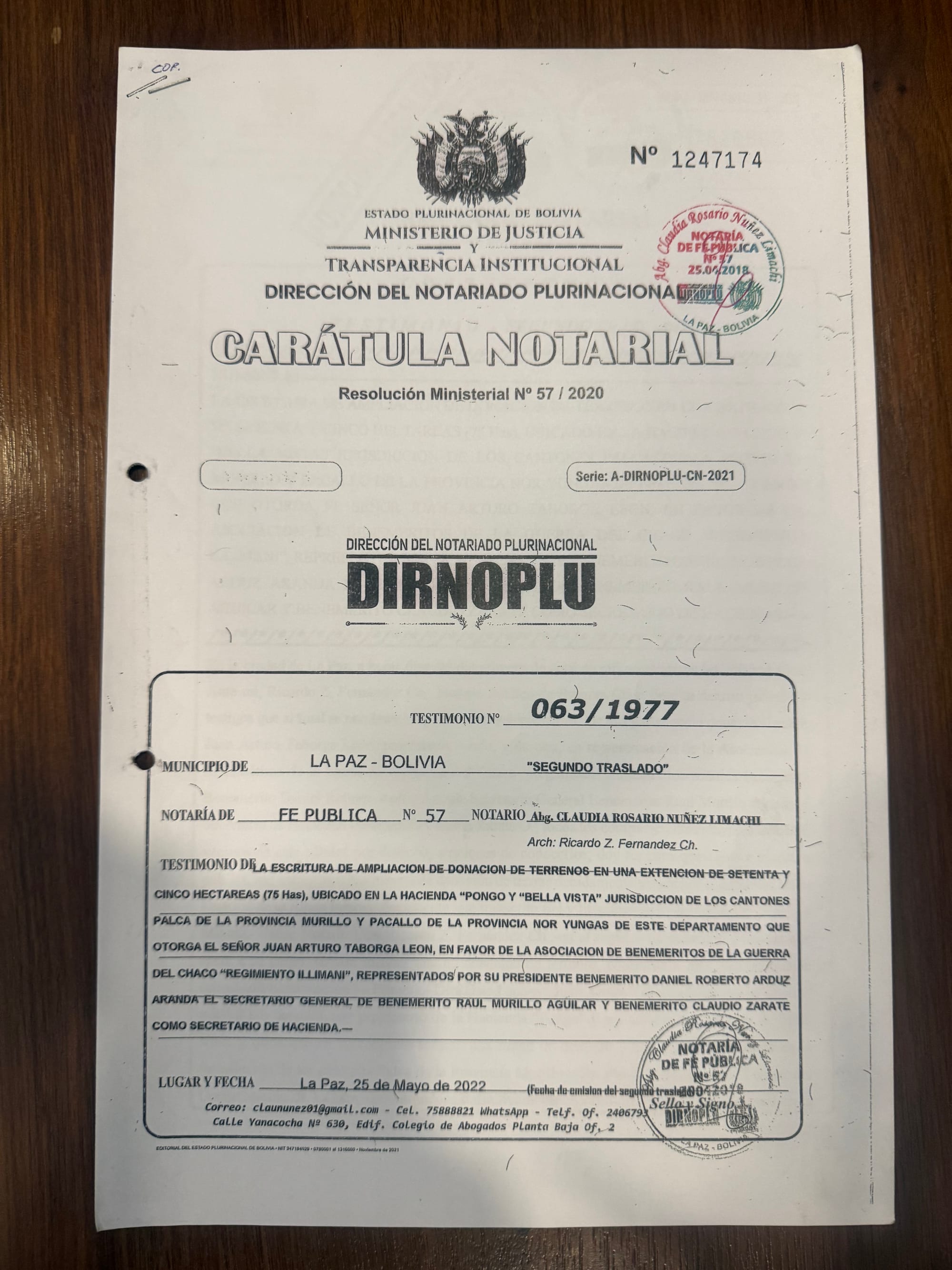
The story of the property runs back through the hacienda system. It belonged to Juan Arturo Taborga León, of Sucre, a benemérito of the Chaco War, who in the 1970s made two donations of land to the Asociación de Beneméritos de la Patria "Regimiento Illimani" — comrades from his own regiment. The first, in 1971, ran to something over thirteen hundred hectares. A second, in 1977, added seventy-five more in the Bella Vista sector.
The 1977 escritura describes that parcel's boundaries in terms that are still legible on the ground: a straight line from the apacheta of Silluni Tinkora to the road from La Paz to the Yungas, and then along the road to the third tunnel, closing the triangle.
I found that unreasonably satisfying. A legal instrument from 1977 that can be walked.
Under the old system the surrounding indigenous communities supplied labor to the hacienda — the pongueaje, from which the people so obligated took the name pongos. The place name has outlived the arrangement. Jaime drew a comparison to the hacienda on the Isla del Sol and the family that held it.
Total surface is a more complicated question than it sounds, and I'm not going to pretend otherwise here. The two donations, the registry entry from 1983, and a modern georeferenced survey each produce a different figure, and they are not measuring the same thing. The survey itself carries a printed observation that it establishes no property right at all.
An association of the beneméritos' children and grandchildren now carries the effort forward, and Jaime is its representative. A caretaker was installed on the land in 1994 and stayed until around 2018, which is roughly when Jaime began the work of regularizing the title — work that is still underway.
The Trail At 3,300 Meters
Coming back up, we emerged from the La Paz end of a tunnel and pulled off so Jaime could point out a property down the mountainside, where an engineer has been recovering the remains of an old railway station and is building a museum around what he has found there, including some small pre-Columbian pieces Jaime was asked to look at. We agreed to arrange a proper visit next time.
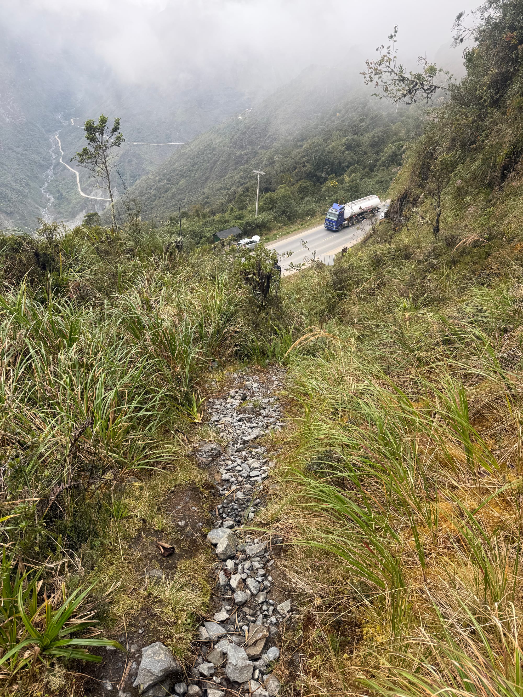
A little farther along we stopped again, at about 3,300 meters, where a pre-Hispanic trail climbs the mountainside directly alongside the modern highway. There is a sign at the trailhead.
I tried to talk myself out of climbing it. This did not work. I knew I would pay for it psychologically at home if I didn't.
Jaime went first, in street shoes. I followed in new Salomons more or less fresh from REI.
He kept an even distance ahead of me the whole way up, which I choose to interpret as courtesy.
How old the trail is, and who built it, are open questions. Jaime thinks parts of the network may predate the Inca. That is a subject for another visit, and probably another post.
Pongo Bella Vista
A little farther on we stopped to see the beginnings of what Jaime is building.
There is a modest clearing just off the road. Stacks of bright red bricks sit on it, sharp against the gray of everything else under a heavy sky. Below, well down the hillside, there is a small collection of houses — seven or eight of them, maybe twenty-five people — including one that is his.
Nothing has been built up top yet. What is there is the bricks and the intention.
He walked me to the spot where he hopes one day to put an interpretive center devoted to the biology, the history and the culture of this place and the Yungas around it. Somewhere for people to arrive and be told where they are.
It's a good vision. Better than good.
I hope I can find a way to contribute to it.
One more tunnel.
The light at the end of it makes me think that it's all very believable.


